First Alert Forecast: Intense heat continues through next week
Heat Advisory through Sunday evening
ATLANTA, Ga. (Atlanta News First) — Through the next few days, North Georgia will continue to see intense heat and pop up storm chances.
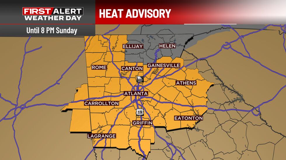
Tonight and Sunday: Heat Advisory Continues
A Heat Advisory remains through 8 PM Sunday for most of the region, with heat index values climbing into the 105-109 degree range on Sunday afternoon.
Overnight lows will only drop to the mid-70s, providing little relief from the intense conditions. The combination of high temperatures and elevated humidity will make it feel uncomfortable both day and night.
We could also see a stray shower or storm in the heat of the afternoon, but, like the front half of the weekend, only an isolated pop-up is expected.
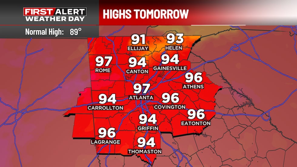
Monday Through Wednesday: The Heat Intensifies
Unfortunately, the relentless heat pattern will persist into next week. Monday is likely to be the warmest day of the extended forecast, with temperatures climbing into the upper 90s for most areas outside the higher elevations. Heat index values will likely remain at or above 105°F areawide.
Expect additional heat advisories to be issued as conditions remain intense through mid-week.
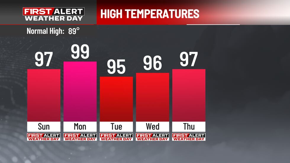
Late Week: Slight Relief Possible
A gradual shift in the weather pattern is expected mid to late week as an upper-level low pressure system approaches from Canada. This will allow the heat ridge to weaken and break down.
By late week, temperatures may dip back to the lower 90s, and rain chances will return with isolated to scattered thunderstorms. However, even with this slight moderation, heat index values will still likely remain in the 90s to low 100s for most of North Georgia.

Copyright 2026 WANF. All rights reserved.