First Alert Forecast: Warming trend begins today, continues through end of week
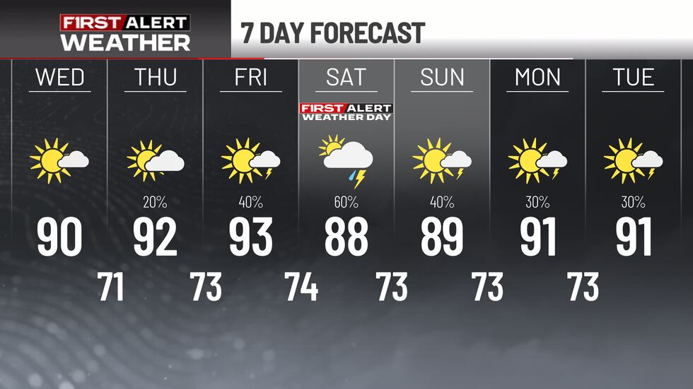
First Alert Weather Day Saturday for numerous showers & storms
ATLANTA, Ga. (Atlanta News First) — The heat isn’t going anywhere just yet. A dome of high pressure is holding strong over the eastern U.S. tonight, and it’s set to stick around for the next few days — keeping our stretch of warm, dry weather in place before rain chances finally return this weekend.
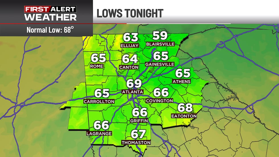
Warm and quiet overnight into Wednesday
Tonight will be mild and mostly clear, with lows settling in the upper 60s to lower 70s. With that high pressure still sitting overhead, Wednesday looks a lot like the day before it: warm, dry, and unremarkable in the best way. Highs will climb into the 90s across north Georgia, while the mountains stay a bit more comfortable in the 80s. Don’t expect much in the way of rain — high pressure is firmly in control.
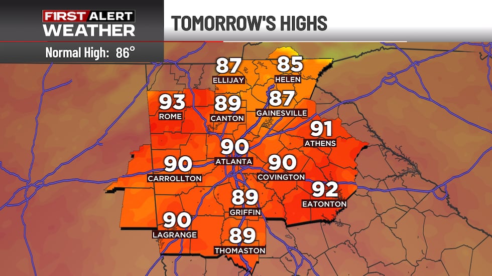
Heat cranks up before relief arrives
That same high pressure sticks around into Thursday, keeping rain chances limited across most of the area. By Friday, though, it starts sliding east as a front approaches. That opens the door for a few scattered showers and thunderstorms across the region. The bigger story will be the heat itself — highs climbing into the low-90s with heat index values pushing near 100s.
Rain chances return for the weekend
That front over the Ohio Valley will try to push southward as we head into the weekend, but it’s expected to stall out just north of Georgia. Even so, the pattern should become more favorable for rain as the high pressure gets nudged out toward the coast. That combination means better rain chances triggering a FIRST ALERT WEATHER DAY for Saturday as scattered to numerous showers and storms are expected.
Copyright 2026 WANF. All rights reserved.